Classbaze

Disclosure: when you buy through links on our site, we may earn an affiliate commission.

QGIS for Beginners #5: Present maps with QGIS3. +FREE eBook

QGIS tutorial: Create maps for your thesis, presentation or report today. PLUS free 70 page eBook. Geography, Q GIS, GIS
4.6
4.6/5
(3 reviews)
103 students
Created by

8.8

Classbaze Grade®

8.3

Freshness

8.4

Popularity

9.1

Material

QGIS tutorial: Create maps for your thesis
Platform: Udemy
Video: 2h 7m
Language: English
Next start: On Demand

Best QGIS classes:

Classbaze Rating

Classbaze Grade®

8.8 / 10

CourseMarks Score® helps students to find the best classes. We aggregate 18 factors, including freshness, student feedback and content diversity.

Freshness

8.3 / 10
This course was last updated on 12/2020.

Course content can become outdated quite quickly. After analysing 71,530 courses, we found that the highest rated courses are updated every year. If a course has not been updated for more than 2 years, you should carefully evaluate the course before enrolling.

Popularity

8.4 / 10
We analyzed factors such as the rating (4.6/5) and the ratio between the number of reviews and the number of students, which is a great signal of student commitment.

New courses are hard to evaluate because there are no or just a few student ratings, but Student Feedback Score helps you find great courses even with fewer reviews.

Material

9.1 / 10
Video Score: 7.9 / 10
The course includes 2h 7m video content. Courses with more videos usually have a higher average rating. We have found that the sweet spot is 16 hours of video, which is long enough to teach a topic comprehensively, but not overwhelming. Courses over 16 hours of video gets the maximum score.
The average video length is 5 hours 46 minutes of 22 QGIS courses on Udemy.
Detail Score: 9.5 / 10

The top online course contains a detailed description of the course, what you will learn and also a detailed description about the instructor.

Extra Content Score: 9.9 / 10

Tests, exercises, articles and other resources help students to better understand and deepen their understanding of the topic.

This course contains:

3 articles.
2 resources.
0 exercise.
0 test.

In this page

About the course

This step-by-step follow-along style introduction to the QGIS layout is a qgis tutorial that will have you creating maps for theses, presentations and reports in no time. There’s also a free 70 page eBook.
In part 1 you’ll download and install the practice dataset. Then you’ll learn basic map design principles.
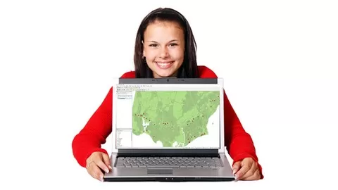
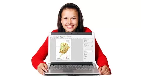
In part 2 you’ll learn how to navigate the QGIS layout, and insert a map and an inset map / locator map, legend, scale bar, and arrange them so that your map is easy for your audience to interpret. Templates will help you create maps faster.
In part 3 you’ll learn how to add text and variables to a layout.
In part 4 you’ll learn how to export your layout into other applications (SVG, geotiff and geopdf). Most of this section is spent on geopdf export. A geopdf is a special type of pdf that includes spatial and attribute information that can be read by adobe acrobat reader. This qgis tutorial is worth doing for the geopdf section alone!
You will learn how to . . .
•Add a map to a layout
•Put a frame around a map and format it
•Add a scalebar
•Add a north arrow
•Use the layout manager to add, delete and rename layouts
•Align objects
•Add a legend
•Create a template from a layout
•Add an inset map / locator map
•Add text to your layout (including variables and a cheats way of formatting html)
•Export your map
•Print at correct scale
•Geotiff, geojpg and Scalable Vector Graphic (SVG)
•Geopdf files for viewing in acrobat reader.
•Setup metadata and map themes that flow through to geopdf and SVG files
If you’ve been thinking about learning QGIS, this qgis tutorial will get you creating maps for you thesis, presentation or report fast. Why wait any longer? Scroll to the top of this page, click the BUY NOW button and start today!

What can you learn from this course?

✓ How to find your way around the QGIS layout
✓ How to insert maps and inset maps / locator maps
✓ How to add legends, scale bars, north arrows
✓ How to use templates
✓ How to design maps that are easy to understand
✓ How to export geotiff, SVG and geopdf files. And metadata to accompany them.
✓ The power of a geopdf in adobe acrobat
✓ How to use variables in text descriptions, and a cheats way to format them in html.

What you need to start the course?

• My QGIS for Beginners #1 course or equivalent. Should be able to launch QGIS, open a QGIS project, a turn map layers on and off.A pdf reader to open the FREE QGIS tutorial e
• Book. A printer too if you wish
• QGIS 3.10+ Long Term Release (LTR) running on MS windows.Nothing else! It’s just you, your computer and your hunger to get started today.

Who is this course is made for?

• Researchers, College Students and Professionals wanting a tool to present maps for theses, presentations and reports

Are there coupons or discounts for QGIS for Beginners #5: Present maps with QGIS3. +FREE eBook ? What is the current price?

The course costs $11.99. And currently there is a 70% discount on the original price of the course, which was $39.99. So you save $28 if you enroll the course now.
The average price is $15.2 of 22 QGIS courses. So this course is 21% cheaper than the average QGIS course on Udemy.

Will I be refunded if I'm not satisfied with the QGIS for Beginners #5: Present maps with QGIS3. +FREE eBook course?

YES, QGIS for Beginners #5: Present maps with QGIS3. +FREE eBook has a 30-day money back guarantee. The 30-day refund policy is designed to allow students to study without risk.

Are there any financial aid for this course?

Currently we could not find a scholarship for the QGIS for Beginners #5: Present maps with QGIS3. +FREE eBook course, but there is a $28 discount from the original price ($39.99). So the current price is just $11.99.

Who will teach this course? Can I trust Ian Allan?

Ian Allan has created 4 courses that got 530 reviews which are generally positive. Ian Allan has taught 8,195 students and received a 4.4 average review out of 530 reviews. Depending on the information available, we think that Ian Allan is an instructor that you can trust.
24 yrs GIS Educator & Consultant: 3 Courses, 5000+ Students!
Hi. It’s great to meet you. QGIS tutorials are what I teach. Take my tutorials and learn to use QGIS!My QGIS tutorials make use of use the free QGIS, They come from the place of an experienced geographer and GIS consultant.* I teach Professional people how to incorporate “spatial” into their projects.* I teach GIS technicians how to work with the non GIS savvy.I have worked with Geographical Information Systems for over two decades. I have worked as an academic at Monash University and a consultant in my own GIS consultancy.GIS is a very broad topic and there are many ways to teach it. My approach is that of a geographer who uses GIS as a tool to solve geographical problems.  Most GISs these days are similarly capable, but for me there is a problem in that too many GIS professionals do not understand the data they manage. Too often I see professionals discussing this-or-that modelling algorithm while failing to understand that the data they’re using for their modelling is not up to the task.Currently based in Victoria, Australia, I have consulted on a diverse range of projects – environmental, sustainability planning, and human. Clients have included the United Nations, the Australian Federal Government, Victorian State Government, Local Governments, Australian Universities, and Water Utilities.  My refereed publications are diverse…* Environmental sustainability modelling for Local Government planning. * Housing affordability modelling for State Government planning. * Buried asset condition modelling for the water industry
Browse all courses by on Classbaze.

8.8

Classbaze Grade®

8.3

Freshness

8.4

Popularity

9.1

Material

Platform: Udemy
Video: 2h 7m
Language: English
Next start: On Demand

Classbaze recommendations for you