Classbaze

Disclosure: when you buy through links on our site, we may earn an affiliate commission.

Remote Sensing for Drought Monitoring in Google Earth Engine

Learn satellite remote sensing, google earth engine, and big data analysis for drought monitoring application
4.5
4.5/5
(29 reviews)
152 students
Created by

9.4

Classbaze Grade®

9.5

Freshness

9.1

Popularity

9.1

Material

Learn satellite remote sensing
Platform: Udemy
Video: 1h 45m
Language: English
Next start: On Demand

Best GIS classes:

Classbaze Rating

Classbaze Grade®

9.4 / 10

CourseMarks Score® helps students to find the best classes. We aggregate 18 factors, including freshness, student feedback and content diversity.

Freshness

9.5 / 10
This course was last updated on 11/2021.

Course content can become outdated quite quickly. After analysing 71,530 courses, we found that the highest rated courses are updated every year. If a course has not been updated for more than 2 years, you should carefully evaluate the course before enrolling.

Popularity

9.1 / 10
We analyzed factors such as the rating (4.5/5) and the ratio between the number of reviews and the number of students, which is a great signal of student commitment.

New courses are hard to evaluate because there are no or just a few student ratings, but Student Feedback Score helps you find great courses even with fewer reviews.

Material

9.1 / 10
Video Score: 7.8 / 10
The course includes 1h 45m video content. Courses with more videos usually have a higher average rating. We have found that the sweet spot is 16 hours of video, which is long enough to teach a topic comprehensively, but not overwhelming. Courses over 16 hours of video gets the maximum score.
The average video length is 5 hours 07 minutes of 88 GIS courses on Udemy.
Detail Score: 9.7 / 10

The top online course contains a detailed description of the course, what you will learn and also a detailed description about the instructor.

Extra Content Score: 9.9 / 10

Tests, exercises, articles and other resources help students to better understand and deepen their understanding of the topic.

This course contains:

2 articles.
4 resources.
0 exercise.
0 test.

In this page

About the course

Do you want to apply satellite remote sensing in drought monitoring?
Do you want to acquire new hands-on Remote Sensing skills to analyze and process satellite data?

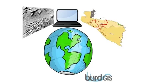
Enroll in my new course Remote Sensing for Drought Monitoring in Google Earth Engine.

I will provide you with hands-on training with example data, sample scripts, and real-world drought monitoring applications.
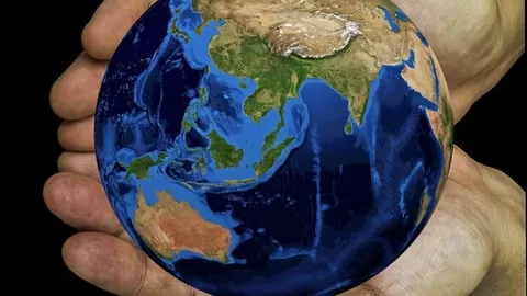
By taking this course, you will take your geospatial data science skills to the next level by gaining proficiency in satellite remote sensing for drought monitoring application with Google Earth Engine, a cloud-based Earth observation data visualization analysis by powered by Google.

What makes me qualified to teach you?
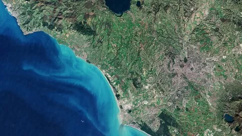
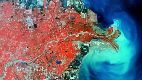
I am Dr. Alemayehu Midekisa, I have over 10 years of experience in processing and analyzing real big Earth observation data from various sources including Landsat, MODIS, Sentinel-2, SRTM and other remote sensing products.
I am also the recipient of one the prestigious NASA Earth and Space Science Fellowship. I teach over 10,000 students on Udemy.
In this Remote Sensing for Drought Monitoring course, I will help you get up and running on the Google Earth Engine cloud platform to process and analyze geospatial data. By the end of this course, you will be equipped with a set of new GIS and Remote Sensing skills including accessing, downloading processing, analyzing, and visualizing big data using JavaScript programming language with GEE cloud platform. In this course, I will use real satellite data including Landsat, MODIS, SMAP, TRMM, GPM and others to provide you a hands-on practical experience of working with Earth observation data.
One of the common problems with learning image processing is the high cost of software. In this course, I entirely use the Google Earth Engine JavaScript open source cloud platform. Additionally, I will walk you through using a step by step video tutorials to process and analyze remote sensing data with GEE. All sample data and script will be provided to you as an added bonus throughout the course.
Jump in right now to enroll. To get started click the enroll button

What can you learn from this course?

✓ Download, process and visualize various satellite data for drought monitoring application
✓ Understand the advantages of using satellites for drought monitoring
✓ Generate various visualizations including time series and histogram charts from remote sensing data
✓ Export satellite data summary
✓ Plot time series data
✓ Calculate anomalies using satellite data

What you need to start the course?

• This course has no requirements.

Who is this course is made for?

• This course is meant for professionals who want to harness the power Google Earth Engine cloud computing platform.
• People who want to understand various satellite image processing techniques for drought monitoring.
• Anyone who wants to learn spatial analysis on the cloud.
• People who are working with satellite remote sensing data such as Landsat, MODIS, Sentinel-2, and SMAP, GRACE, and GPM.
• Anyone who wants to apply for GIS or Remote Sensing Specialist job position.

Are there coupons or discounts for Remote Sensing for Drought Monitoring in Google Earth Engine ? What is the current price?

The course costs $16.99. And currently there is a 82% discount on the original price of the course, which was $94.99. So you save $78 if you enroll the course now.
The average price is $14.0 of 88 GIS courses. So this course is 21% more expensive than the average GIS course on Udemy.

Will I be refunded if I'm not satisfied with the Remote Sensing for Drought Monitoring in Google Earth Engine course?

YES, Remote Sensing for Drought Monitoring in Google Earth Engine has a 30-day money back guarantee. The 30-day refund policy is designed to allow students to study without risk.

Are there any financial aid for this course?

Currently we could not find a scholarship for the Remote Sensing for Drought Monitoring in Google Earth Engine course, but there is a $78 discount from the original price ($94.99). So the current price is just $16.99.

Who will teach this course? Can I trust Alemayehu Midekisa?

Alemayehu Midekisa has created 21 courses that got 2,115 reviews which are generally positive. Alemayehu Midekisa has taught 18,725 students and received a 4.1 average review out of 2,115 reviews. Depending on the information available, we think that Alemayehu Midekisa is an instructor that you can trust.
Lead Instructor & Geospatial Data Scientist
Dr. Alemayehu Midekisa, PhD is an applied remote sensing scientist with 15 plus years of expertise in big Earth observation data and various methods such as machine learning, time series analysis, deep learning, and cloud computing. He is proficient in different scripting languages including Python, JavaScript, R, and Google Earth Engine. He is a former NASA Earth and Space Science fellow. With global experience in USA, Europe and Africa, his research focus is in the application of multi-sensor remote sensing data utilizing Landsat, VIIRS, Sentinel 2, MODIS, GPM, and SMAP to answer complex environmental problems in land use, water resource, agriculture, and public health.
Browse all courses by on Classbaze.

9.4

Classbaze Grade®

9.5

Freshness

9.1

Popularity

9.1

Material

Platform: Udemy
Video: 1h 45m
Language: English
Next start: On Demand

Classbaze recommendations for you