Classbaze

Disclosure: when you buy through links on our site, we may earn an affiliate commission.

ArcGIS Desktop For Spatial Analysis: Go From Basic To Pro

Spatial Data Analysis With ArcGIS Desktop: Master GIS Techniques and Open Doors to Amazing Geospatial Careers
4.4
4.4/5
(1,233 reviews)
5,986 students
Created by

9.5

Classbaze Grade®

9.5

Freshness

9.0

Popularity

9.3

Material

Spatial Data Analysis With ArcGIS Desktop: Master GIS Techniques and Open Doors to Amazing Geospatial Careers
Platform: Udemy
Video: 4h 52m
Language: English
Next start: On Demand

Best Spatial Analysis classes:

Classbaze Rating

Classbaze Grade®

9.5 / 10

CourseMarks Score® helps students to find the best classes. We aggregate 18 factors, including freshness, student feedback and content diversity.

Freshness

9.5 / 10
This course was last updated on 11/2021.

Course content can become outdated quite quickly. After analysing 71,530 courses, we found that the highest rated courses are updated every year. If a course has not been updated for more than 2 years, you should carefully evaluate the course before enrolling.

Popularity

9.0 / 10
We analyzed factors such as the rating (4.4/5) and the ratio between the number of reviews and the number of students, which is a great signal of student commitment.

New courses are hard to evaluate because there are no or just a few student ratings, but Student Feedback Score helps you find great courses even with fewer reviews.

Material

9.3 / 10
Video Score: 8.3 / 10
The course includes 4h 52m video content. Courses with more videos usually have a higher average rating. We have found that the sweet spot is 16 hours of video, which is long enough to teach a topic comprehensively, but not overwhelming. Courses over 16 hours of video gets the maximum score.
The average video length is 4 hours 05 minutes of 16 Spatial Analysis courses on Udemy.
Detail Score: 10.0 / 10

The top online course contains a detailed description of the course, what you will learn and also a detailed description about the instructor.

Extra Content Score: 9.5 / 10

Tests, exercises, articles and other resources help students to better understand and deepen their understanding of the topic.

This course contains:

0 article.
2 resources.
0 exercise.
0 test.

In this page

About the course

I WANNA LEARN SPATIAL DATA ANALYSIS, BUT…
•I found most spatial data books & manuals vague
•There are no courses that actually teach me how it’s actually done
•Available resources are expensive & I can’t afford them
•I want to get a job in the field of GIS and geospatial analysis
•I work in the field of ecology or quantitative social sciences or hydrology or civil engineering or geography
If you found yourself in one of these situations, then..
I’VE GOT GREAT NEWS FOR YOU!
Over the past few months, I have published multiple courses on Udemy around this topic which will be tremendously helpful to you & most important of all AFFORDABLE!
Today, I’ve created yet another powerful resource for you!
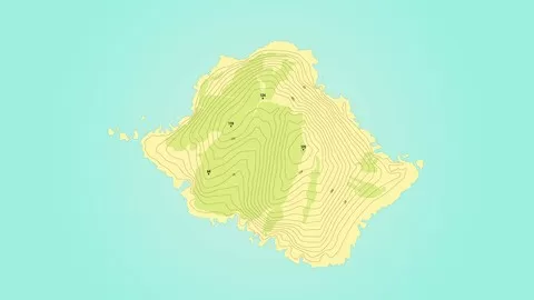
In this course, over 50+ hands-on and practical lecture, I will help you master the most common and important geo-processing tasks that can be performed with ArcGIS Desktop, one of THE MOST important GIS software tools available.
I will also show you the kind of questions answered through Spatial Analysis & data used.
THE STEPS I’LL WALK YOU THROUGH:
First of all, we’ll start some basic GIS tasks like “Zooming”.
Then, we’ll move into more complex processing tasks like “Geo-Statistics”.
We’ll also deal with some theoretical concepts related to Spatial Data Analysis, and then we’ll focus on implementing some of the most common GIS techniques (all the way showing you how to execute these tasks in ArcGIS Desktop).
The stuff you’ll learn from this course will be extremely useful in terms of you being able to implement it on future Spatial Data projects you’ll be working on (in a variety of disciplines from ecology to engineering).
LEARN FROM AN ACTUAL EXPERT IN THIS AREA:
My name is MINERVA SINGH.
I am an Oxford University MPhil (Geography and Environment) graduate.
I recently finished my PhD at Cambridge University (Tropical Ecology and Conservation).
I have SEVERAL YEARS OF EXPERIENCE in analyzing REAL LIFE DATA from different sources in ArcGIS Desktop.
I’ve also published my work in many international peer reviewed journals.
HERE IS HOW MY COURSE IS UNIQUE..
My course is a HANDS ON TRAINING with REAL data.
It’s a step by step course covering both the THEORY & APPLICATION of Spatial Data Analysis.
I teach Practical Stuff that you can learn quickly and start implementing NOW.
This is one of the most comprehensive courses on this topic.
I advise you to take advantage of it & enroll in the course TODAY!
TAKE ACTION TODAY! I will personally support you and ensure your experience with this course is a success. I answer all questions put to me and guide my students when they get stuck. 
Please make sure you have access to ArcGIS before enrolling

What can you learn from this course?

✓ Have a thorough knowledge of the ArcGIS Interface and Functionality
✓ Learn about the different toolboxes in ArcGIS and what they can do
✓ Carry out practical spatial data analysis tasks, geo-processing and mapping using ArcGIS Desktop
✓ Learn about advanced topics such as geostatistics and carry them out on actual data
✓ Visualize and map spatial data
✓ Show off your skills to employers by working with actual spatial data & presenting the outputs as maps
✓ Start analyzing spatial data for your own projects in ArcGIS Desktop like a pro

What you need to start the course?

• An interest in working with spatial data.
• Prior knowledge of basic spatial data related concepts such as the different data types and coordinate systems
• Access to ArcGIS Desktop version 10 or above
• License for the Spatial Analyst extension of ArcGIS version 10
• You can certainly take the course even without ArcGIS access (free trial available on the ESRI website)

Who is this course is made for?

• Academics and Researchers
• Conservation managers, field ecologists and social scientists
• People looking to get started in the field of GIS Analysis
• Students of Geography, Environmental Sciences, Geology, Hydrology, Engineering, Earth Sciences and Ecology
• People looking to use ArcGIS Desktop in academic or professional settings

Are there coupons or discounts for ArcGIS Desktop For Spatial Analysis: Go From Basic To Pro ? What is the current price?

The course costs $18.99. And currently there is a 83% discount on the original price of the course, which was $109.99. So you save $91 if you enroll the course now.
The average price is $16.3 of 16 Spatial Analysis courses. So this course is 17% more expensive than the average Spatial Analysis course on Udemy.

Will I be refunded if I'm not satisfied with the ArcGIS Desktop For Spatial Analysis: Go From Basic To Pro course?

YES, ArcGIS Desktop For Spatial Analysis: Go From Basic To Pro has a 30-day money back guarantee. The 30-day refund policy is designed to allow students to study without risk.

Are there any financial aid for this course?

Currently we could not find a scholarship for the ArcGIS Desktop For Spatial Analysis: Go From Basic To Pro course, but there is a $91 discount from the original price ($109.99). So the current price is just $18.99.

Who will teach this course? Can I trust Minerva Singh?

Minerva Singh has created 46 courses that got 16,390 reviews which are generally positive. Minerva Singh has taught 82,987 students and received a 4.5 average review out of 16,390 reviews. Depending on the information available, we think that Minerva Singh is an instructor that you can trust.
Bestselling Instructor & Data Scientist(Cambridge Uni)
I completed a PhD (University of Cambridge, UK) in 2017 where I focussed on implementing data science techniques for quantifying the impact of forest loss on tropical ecosystems. I hold an MPhil (School of Geography and Environment) and an MSc (Department of Engineering) from Oxford University. I have more than 10 year’s experience in conducting academic research (published in high level peer-reviewed international scientific journals such as PLOS One) and advising both non-governmental and industry stakeholders in data science, deep learning and earth observation (EO) related topics. I have a strong track record in implementing machine learning, data visualization, spatial data analysis, deep learning and natural language processing tasks using both R and Python. In addition to being educated at the best universities in the world, I have honed my statistical and data analysis skills through many MOOCs, including The Analytics Edge (R based statistics and machine learning course offered by EdX), Statistical Learning (R-based Machine Learning course offered by Stanford online) and the IBM Data Science Professional certificate Track. I specialise in a variety of topics ranging from deep learning (Tensorflow, Keras) to machine learning to spatial data analysis (including EO data processing), data visualizations, natural language processing, financial analysis among others. I have acted as a peer reviewer on highly regarded academic journals such as Remote Sensing and given guest lectures on prestigious forums such as Open Data Science Conference (ODSC).
Browse all courses by on Classbaze.

9.5

Classbaze Grade®

9.5

Freshness

9.0

Popularity

9.3

Material

Platform: Udemy
Video: 4h 52m
Language: English
Next start: On Demand

Classbaze recommendations for you