Classbaze

Disclosure: when you buy through links on our site, we may earn an affiliate commission.

Complete Google Earth Engine for Remote Sensing & GIS

Harness the Power of Google Earth Engine for GIS Spatial Data Analysis & Remote Sensing
4.3
4.3/5
(1,006 reviews)
4,475 students
Created by

9.4

Classbaze Grade®

9.4

Freshness

8.9

Popularity

9.4

Material

Harness the Power of Google Earth Engine for GIS Spatial Data Analysis & Remote Sensing
Platform: Udemy
Video: 5h 12m
Language: English
Next start: On Demand

Best Spatial Analysis classes:

Classbaze Rating

Classbaze Grade®

9.4 / 10

CourseMarks Score® helps students to find the best classes. We aggregate 18 factors, including freshness, student feedback and content diversity.

Freshness

9.4 / 10
This course was last updated on 10/2021.

Course content can become outdated quite quickly. After analysing 71,530 courses, we found that the highest rated courses are updated every year. If a course has not been updated for more than 2 years, you should carefully evaluate the course before enrolling.

Popularity

8.9 / 10
We analyzed factors such as the rating (4.3/5) and the ratio between the number of reviews and the number of students, which is a great signal of student commitment.

New courses are hard to evaluate because there are no or just a few student ratings, but Student Feedback Score helps you find great courses even with fewer reviews.

Material

9.4 / 10
Video Score: 8.4 / 10
The course includes 5h 12m video content. Courses with more videos usually have a higher average rating. We have found that the sweet spot is 16 hours of video, which is long enough to teach a topic comprehensively, but not overwhelming. Courses over 16 hours of video gets the maximum score.
The average video length is 4 hours 05 minutes of 16 Spatial Analysis courses on Udemy.
Detail Score: 10.0 / 10

The top online course contains a detailed description of the course, what you will learn and also a detailed description about the instructor.

Extra Content Score: 9.9 / 10

Tests, exercises, articles and other resources help students to better understand and deepen their understanding of the topic.

This course contains:

2 articles.
46 resources.
0 exercise.
0 test.

In this page

About the course

ENROLL IN MY LATEST COURSE ON HOW TO LEARN ALL ABOUT BASIC SATELLITE REMOTE SENSING AND GIS ANALYSIS USING GOOGLE EARTH ENGINE (GEE).
Are you currently enrolled in any of my GIS and remote sensing related courses?
Or perhaps you have prior experience in GIS or tools like R and QGIS?
You don’t want to spend 100s and 1000s of dollars on buying commercial software for imagery analysis?
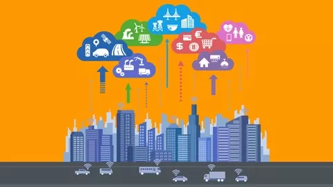
The next step for you is to gain proficiency in satellite remote sensing data analysis and GIS using GEE, a cloud based endeavor by Google that can help process several petra-byte of imagery data
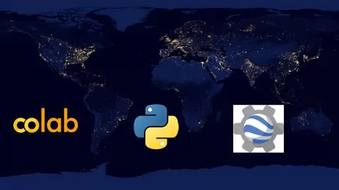
MY COURSE IS A HANDS ON TRAINING WITH REAL REMOTE SENSING AND GIS DATA ANALYSIS WITH GOOGLE EARTH ENGINE- A planetary-scale platform for Earth science data & analysis; powered by Google’s cloud infrastructure. !
My course provides a foundation to carry out PRACTICAL, real-life remote sensing and GIS analysis tasks in this powerful cloud-supported paltform . By taking this course, you are taking an important step forward in your GIS journey to become an expert in geospatial analysis.
Why Should You Take My Course?
I am an Oxford University MPhil (Geography and Environment) graduate. I also completed a PhD at Cambridge University (Tropical Ecology and Conservation).
I have several years of experience in analyzing real life spatial remote sensing data from different sources and producing publications for international peer reviewed journals.
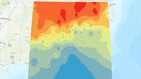
In this course, actual satellite remote sensing data such as Landsat from USGS and radar data from JAXA  will be used to give a practical hands-on experience of working with remote sensing and understanding what kind of questions remote  sensing can help us answer.
This course will ensure you learn & put remote sensing data analysis into practice today and increase your proficiency in geospatial analysis.
Remote sensing software tools are very expensive, and their cost can run into thousands of dollars. Instead of shelling out so much money or procuring pirated copies (which puts you at arisk of prosecution), you will learn to carry out some of the most important and common remote sensing analysis tasks using one of the most powerful earth observation data and analysis platform.  GEE is rapidly demonstrating its importance in the geo-spatial sector and improving your skills in GEE will give you an edge over other job applicants..
This is a fairly comprehensive course, i.e. we will focus on learning the most important and widely encountered remote sensing data processing and and GIS analysis techniques in Google Earth Engine
You will also learn about the different sources of remote sensing data there are and how to obtain these FREE OF CHARGE and process them using within GEE.
In addition to all the above, you’ll have MY CONTINUOUS SUPPORT to make sure you get the most value out of your investment!
ENROLL NOW 🙂

What can you learn from this course?

✓ Students will gain access to and a thorough knowledge of the Google Earth Engine platform
✓ Carry out pre-processing and processing of satellite data in the cloud
✓ Implement some of the most common GIS techniques on satellite data
✓ Implement time series analysis of multi-temporal optical data
✓ Implement machine learning algorithms on satellite data
✓ Gain proficiency in JavaScript for satellite data processing

What you need to start the course?

• Desire to learn satellite data processing using Google Earth Engine
• Desire to learn common pre-processing and GIS techniques in Google Earth Engine
• Prior knowledge of the different common GIS data types

Who is this course is made for?

• People who wish to harness the power of cloud computing and Google Earth Engine for processing satellite data
• People wanting to learn about satellite imagery processing and deriving insights from these data
• People wanting to work with long term temporal long term optical satellite images such as MODIS
• People wanting to implement machine learning algorithms on satellite data
• Students of forestry, environment, geography and environmental sciences

Are there coupons or discounts for Complete Google Earth Engine for Remote Sensing & GIS ? What is the current price?

The course costs $19.99. And currently there is a 84% discount on the original price of the course, which was $124.99. So you save $105 if you enroll the course now.
The average price is $16.3 of 16 Spatial Analysis courses. So this course is 23% more expensive than the average Spatial Analysis course on Udemy.

Will I be refunded if I'm not satisfied with the Complete Google Earth Engine for Remote Sensing & GIS course?

YES, Complete Google Earth Engine for Remote Sensing & GIS has a 30-day money back guarantee. The 30-day refund policy is designed to allow students to study without risk.

Are there any financial aid for this course?

Currently we could not find a scholarship for the Complete Google Earth Engine for Remote Sensing & GIS course, but there is a $105 discount from the original price ($124.99). So the current price is just $19.99.

Who will teach this course? Can I trust Minerva Singh?

Minerva Singh has created 46 courses that got 16,390 reviews which are generally positive. Minerva Singh has taught 82,987 students and received a 4.5 average review out of 16,390 reviews. Depending on the information available, we think that Minerva Singh is an instructor that you can trust.
Bestselling Instructor & Data Scientist(Cambridge Uni)
I completed a PhD (University of Cambridge, UK) in 2017 where I focussed on implementing data science techniques for quantifying the impact of forest loss on tropical ecosystems. I hold an MPhil (School of Geography and Environment) and an MSc (Department of Engineering) from Oxford University. I have more than 10 year’s experience in conducting academic research (published in high level peer-reviewed international scientific journals such as PLOS One) and advising both non-governmental and industry stakeholders in data science, deep learning and earth observation (EO) related topics. I have a strong track record in implementing machine learning, data visualization, spatial data analysis, deep learning and natural language processing tasks using both R and Python. In addition to being educated at the best universities in the world, I have honed my statistical and data analysis skills through many MOOCs, including The Analytics Edge (R based statistics and machine learning course offered by EdX), Statistical Learning (R-based Machine Learning course offered by Stanford online) and the IBM Data Science Professional certificate Track. I specialise in a variety of topics ranging from deep learning (Tensorflow, Keras) to machine learning to spatial data analysis (including EO data processing), data visualizations, natural language processing, financial analysis among others. I have acted as a peer reviewer on highly regarded academic journals such as Remote Sensing and given guest lectures on prestigious forums such as Open Data Science Conference (ODSC).
Browse all courses by on Classbaze.

9.4

Classbaze Grade®

9.4

Freshness

8.9

Popularity

9.4

Material

Platform: Udemy
Video: 5h 12m
Language: English
Next start: On Demand

Classbaze recommendations for you