Classbaze

Disclosure: when you buy through links on our site, we may earn an affiliate commission.

Geospatial Analyses & Remote Sensing : from Beginner to Pro

Learn Remote Sensing, QGIS & GIS , main concepts, machine learning, QGIS classification, change detection, Earth Engine
4.3
4.3/5
(200 reviews)
2,278 students
Created by

9.4

Classbaze Grade®

9.9

Freshness

8.1

Popularity

9.6

Material

Learn Remote Sensing
Platform: Udemy
Video: 8h 47m
Language: English
Next start: On Demand

Best GIS classes:

Classbaze Rating

Classbaze Grade®

9.4 / 10

CourseMarks Score® helps students to find the best classes. We aggregate 18 factors, including freshness, student feedback and content diversity.

Freshness

9.9 / 10
This course was last updated on 3/2022.

Course content can become outdated quite quickly. After analysing 71,530 courses, we found that the highest rated courses are updated every year. If a course has not been updated for more than 2 years, you should carefully evaluate the course before enrolling.

Popularity

8.1 / 10
We analyzed factors such as the rating (4.3/5) and the ratio between the number of reviews and the number of students, which is a great signal of student commitment.

New courses are hard to evaluate because there are no or just a few student ratings, but Student Feedback Score helps you find great courses even with fewer reviews.

Material

9.6 / 10
Video Score: 8.9 / 10
The course includes 8h 47m video content. Courses with more videos usually have a higher average rating. We have found that the sweet spot is 16 hours of video, which is long enough to teach a topic comprehensively, but not overwhelming. Courses over 16 hours of video gets the maximum score.
The average video length is 5 hours 07 minutes of 88 GIS courses on Udemy.
Detail Score: 10.0 / 10

The top online course contains a detailed description of the course, what you will learn and also a detailed description about the instructor.

Extra Content Score: 9.9 / 10

Tests, exercises, articles and other resources help students to better understand and deepen their understanding of the topic.

This course contains:

2 articles.
27 resources.
0 exercise.
0 test.

In this page

About the course

Geospatial Data Analyses & Remote Sensing: 5 Classes in 1
Do you need to design a GIS map or satellite-imagery based map for your  Remote Sensing or GIS project but you don’t know how to do this?
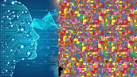
Have you heard about  Remote Sensing object-based image analysis and machine learning or maybe QGIS or Google Earth Engine but did not know where to start with such analyses?
Do you find Remote Sensing and GIS manuals too not practical and looking for a course that takes you by hand, teach you all the concepts, and get you started on a real-life GIS mapping project?
I’m very excited that you found my Practical Geospatial Masterclass on Geospatial Data Analyses & Remote Sensing. This course provides and information that is usually delivered in 4 separate Geospatial Data Analyses & Remote Sensing courses, and thus you with learning all the necessary information to start and advance with Geospatial analysis and includes more than 9 hours of video content, plenty of practical analysis, and downloadable materials. After taking this course, you will be able to implement PRACTICAL, real-life spatial geospatial analysis and tasks, including land use and land cover mapping and change detection, machine learning for GIS, data, and maps creation, etc. in popular and FREE software tools.
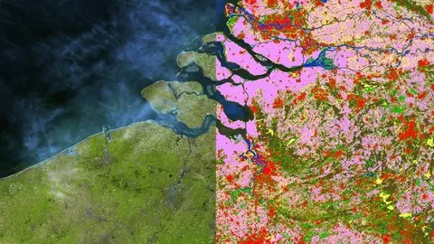
This course is designed to equip you with the theoretical and practical knowledge of applied geospatial analysis, namely Remote Sensing and some Geographic Information Systems (GIS). By the end of the course, you will feel confident and completely understand the basics of Remote Sensing and GIS, learn Machine Learning applications in GIS / Remote Sensing technology, and how to use Machine Learning algorithms for various geospatial & Remote Sensing tasks, such as land use and land cover mapping (classifications) and object-based image analysis (segmentation, crop type mapping, etc). This course will also prepare you for using geospatial and Remote Sensing analysis with open source and free software tools.
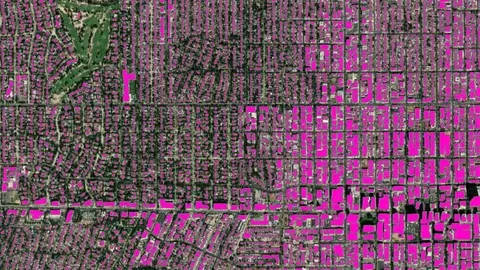
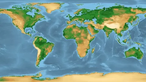
In the course, you will be able to apply in QGIS such Machine Learning algorithms like Random Forest, Support Vector Machines and Decision Trees (and others) for classification of satellite imagery. You will also learn how to download and process satellite imagery, conduct supervised and unsupervised learning, implement accuracy assessment, apply object-based image analysis, and change detection. On top of that, you will practice geospatial &  Remote Sensing analysis by completing an entire classification project by exploring the power of Machine Learning, cloud computing, and Big Data analysis using Google Erath Engine for any geographic area in the world.
In this course, I will teach you how to work with the popular open-source GIS &  Remote Sensing, i.e. QGIS software, and its great tools: Semi-Automated classification plugin and Orfeo (OTB) toolbox. You will also get introduced to cloud computing and Big Data analysis using Google Erath Engine for any geographic area in the world.
The course is ideal for professionals such as geographers, programmers, social scientists, geologists, GIS &  Remote Sensing experts, and all other experts who need to use maps in their field and would like to learn more about Machine Learning in GIS &  Remote Sensing and QGIS. If you’re planning to undertake a task that requires to use a state of the art Machine Learning algorithms for creating, for instance, land cover and land use maps in QGIS and Google Earth Engine, this course will give you the confidence you need to understand and solve such geospatial problem.
One important part of the course is the practical exercises. You will be given some precise instructions on  Remote Sensing analysis, downloadable practical materials, scripts, and datasets to create maps and conduct analysis based on Machine Learning algorithms using the QGIS software and Google Earth Engine.

What can you learn from this course?

✓ Understand and implement basic concepts of Geographic Information Systems (GIS) and Remote Sensing
✓ Fully understand the basics of Land use and Land Cover (LULC) Mapping and Change Detection in QGIS
✓ Learn the most popular open-source GIS and Remote Sensing software tools (QGIS), Semi-automated classification (SCP) plugin, OTB toolbox)
✓ Learn how to obtain satellite data, apply image preprocessing, create training and validation data in QGIS
✓ Create your first GIS maps for your reports/presentations in QGIS
✓ Understand machine learning concepts and its application in GIS and Remote Sensing
✓ Apply Machine Learning image classification mapping and change detection in SCP, OTB toolbox and QGIS
✓ Fully understand and apply advanced methods in machine learning in GIS and Remote Sensing, such as random forest classification and object-based image analysis,
✓ You’ll have a copy of the labs, step-by-step manuals and scripts used in the course for QGIS & more

What you need to start the course?

• A working computer
• An interest in working with spatial data
• The course will be demonstrated using a QGIS version of Windows PC. Mac and Linux users will have to adapt the instructions to their operating systems.

Who is this course is made for?

• Geographers, Programmers, geologists, biologists, social scientists, or everyone who deals with GIS maps in their field or would like to learn GIS and Remote Sensing

Are there coupons or discounts for Geospatial Analyses & Remote Sensing : from Beginner to Pro ? What is the current price?

The course costs $14.99. And currently there is a 79% discount on the original price of the course, which was $69.99. So you save $55 if you enroll the course now.
The average price is $14.0 of 88 GIS courses. So this course is 7% more expensive than the average GIS course on Udemy.

Will I be refunded if I'm not satisfied with the Geospatial Analyses & Remote Sensing : from Beginner to Pro course?

YES, Geospatial Analyses & Remote Sensing : from Beginner to Pro has a 30-day money back guarantee. The 30-day refund policy is designed to allow students to study without risk.

Are there any financial aid for this course?

Currently we could not find a scholarship for the Geospatial Analyses & Remote Sensing : from Beginner to Pro course, but there is a $55 discount from the original price ($69.99). So the current price is just $14.99.

Who will teach this course? Can I trust Kate Alison?

Kate Alison has created 34 courses that got 2,880 reviews which are generally positive. Kate Alison has taught 76,591 students and received a 4.3 average review out of 2,880 reviews. Depending on the information available, we think that Kate Alison is an instructor that you can trust.
GIS & Data Science
I am a passionate data science expert and educator.  I do regular teaching and training all over the world. I have many satisfied students! And now I will be glad if I can teach also you these interesting, highly applied, and exciting topics!

For GIS & Remote Sensing students:
Order of how to take my courses:
Option 1: Take all individual courses that contain more details  and more labs in the following order:
1. Get started with GIS & Remote Sensing in QGIS #Beginners
2. Remote Sensing in QGIS: Fundamentals of Image Analysis 2020
3. Core GIS: Land Use and Land Cover & Change Detection in QGIS
4. Machine Learning in GIS: Understand the Theory and Practice
5. Machine Learning in GIS: Land Use/Land Cover Image Analysis
6. Machine Learning in ArcGIS: Map Land Use/ Land Cover in GIS
7. Object-based image analysis & classification in QGIS/ArcGIS
8. ArcGIS: Learn Deep Learning in ArcGIS to advance GIS skills
8. Google Earth Engine for Big GeoData Analysis: 3 Courses in 1
10. Google Earth Engine for Machine Learning & Change Detection
11. QGIS & Google Earth Engine for Environmental Applications
12. Advanced Remote Sensing Analysis in QGIS and on cloud
Option 2: Take my combi-courses that contain summarized information from the above courses, though in fewer details (labs, videos):
1. Geospatial Data Analyses & Remote Sensing: 4 Classes in 1
2. Machine Learning in GIS and Remote Sensing: 5 Courses in 1
3. Google Earth Engine for Big GeoData Analysis: 3 Courses in 1
4. Google Earth Engine for Machine Learning & Change Detection
5. Advanced Remote Sensing Analysis in QGIS and on cloud
Browse all courses by on Classbaze.

9.4

Classbaze Grade®

9.9

Freshness

8.1

Popularity

9.6

Material

Platform: Udemy
Video: 8h 47m
Language: English
Next start: On Demand

Classbaze recommendations for you