Classbaze

Disclosure: when you buy through links on our site, we may earn an affiliate commission.

Land use Land cover classification GIS, ERDAS, ArcGIS, ENVI

Land Use Scratch to Advance, All Softwares of Remote Sensing and GIS. Machine Learning, GIS Tasks in Easy way learning.
4.2
4.2/5
(458 reviews)
2,381 students
Created by

9.0

Classbaze Grade®

8.5

Freshness

8.6

Popularity

9.3

Material

Land Use Scratch to Advance
Platform: Udemy
Video: 6h 23m
Language: English
Next start: On Demand

Best GIS classes:

Classbaze Rating

Classbaze Grade®

9.0 / 10

CourseMarks Score® helps students to find the best classes. We aggregate 18 factors, including freshness, student feedback and content diversity.

Freshness

8.5 / 10
This course was last updated on 2/2021.

Course content can become outdated quite quickly. After analysing 71,530 courses, we found that the highest rated courses are updated every year. If a course has not been updated for more than 2 years, you should carefully evaluate the course before enrolling.

Popularity

8.6 / 10
We analyzed factors such as the rating (4.2/5) and the ratio between the number of reviews and the number of students, which is a great signal of student commitment.

New courses are hard to evaluate because there are no or just a few student ratings, but Student Feedback Score helps you find great courses even with fewer reviews.

Material

9.3 / 10
Video Score: 8.5 / 10
The course includes 6h 23m video content. Courses with more videos usually have a higher average rating. We have found that the sweet spot is 16 hours of video, which is long enough to teach a topic comprehensively, but not overwhelming. Courses over 16 hours of video gets the maximum score.
The average video length is 5 hours 07 minutes of 88 GIS courses on Udemy.
Detail Score: 9.6 / 10

The top online course contains a detailed description of the course, what you will learn and also a detailed description about the instructor.

Extra Content Score: 9.9 / 10

Tests, exercises, articles and other resources help students to better understand and deepen their understanding of the topic.

This course contains:

2 articles.
3 resources.
0 exercise.
0 test.

In this page

About the course

This is the first landuse landcover course on Udemy the most demanding topic in GIS, In this course, I covered from data download to final results. I used ERDAS, ArcGIS, ENVI and MACHINE LEARNING. I explained all the possible methods of land use classification. More then landuse, Pre-Procession of images are covered after download and after classification, how to correct error pixels are also covered, So after learning here you no need to ask anyone about lanudse classification. I explained the theoretical concept also during the processing of data. I have covered supervised, unsupervised, combined method, pixel correction methods etc. I have also shown to correct area-specific pixels to achieve maximum accuracy. Most of this course is focused on Erdas and ArcGIS for image classification and calculations. For in-depth of all methods enrol in this course.  Image classification with Machine learning also covered in this course.
This course also includes an accuracy assessment report generation in erdas. 
Note: Each Land Use method  Section covers different Method from the beginning, So before starting landuse watch the entire course. Then start land use with a method that you think easy for you and best fit for your study area., then you will be able to it best. Different method is applicable to a different type of study area. This course is applicable to Erdas Version 2014, 2015, 2016 and 2018. and ArcGIS Version 10.1 and above, i.e 10.4, 10.7 or 10.8

90% practical 10% theory
Problem faced During classification:
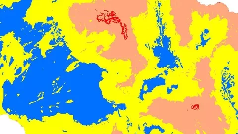
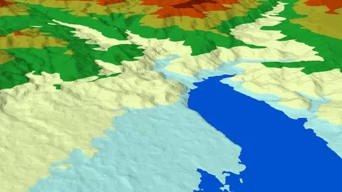
Some of us faced problem during classification as:
•Urban area and barren land has the same signature
•Dry river reflect the same signature as an urban area and barren land
•if you try to correct urban and get an error in barren
•In Hilly area you cannot classify forest which is in the hill shade area. 
•Add new class after final work
How to get rid of this all problems Join this course.

What can you learn from this course?

✓ Able to do a Prefect Land use classification of Earth using satellite image
✓ Also learn image Processing and analysis in depth
✓ Landuse change Detection
✓ Understand Features identification on Earth using Landsat Image
✓ Post Landuse Pixel level corrections
✓ Accuracy Assessment Report
✓ Downloading of best satellite image and process
✓ Understanding FCC satellite image and bands
✓ Pixel level correction in land use at specific area and statistical filters
✓ Calculate area from Pixels
✓ Generate new class after final landuse
✓ Learn all best method of classification.
✓ How to achieve maximum accuracy of classification
✓ Cut Study Area
✓ Classify with Machine Learning
✓ Support Vector Machine
✓ Random Forest

What you need to start the course?

• You must have ArcGIS and ERDAS or ENVI
• You must have basic knowledge of GIS

Who is this course is made for?

• Civil Engineers
• Water Resource Experts
• Master Student of GIS
• PhD Students of Satellite Data Analysis
• Research Scholars
• GIS Analyst
• Environment and Earth Science Persons
• Urban and city Planner

Are there coupons or discounts for Land use Land cover classification GIS, ERDAS, ArcGIS, ENVI ? What is the current price?

The course costs $14.99. And currently there is a 67% discount on the original price of the course, which was $44.99. So you save $30 if you enroll the course now.
The average price is $14.0 of 88 GIS courses. So this course is 7% more expensive than the average GIS course on Udemy.

Will I be refunded if I'm not satisfied with the Land use Land cover classification GIS, ERDAS, ArcGIS, ENVI course?

YES, Land use Land cover classification GIS, ERDAS, ArcGIS, ENVI has a 30-day money back guarantee. The 30-day refund policy is designed to allow students to study without risk.

Are there any financial aid for this course?

Currently we could not find a scholarship for the Land use Land cover classification GIS, ERDAS, ArcGIS, ENVI course, but there is a $30 discount from the original price ($44.99). So the current price is just $14.99.

Who will teach this course? Can I trust Lakhwinder Singh?

Lakhwinder Singh has created 6 courses that got 1,467 reviews which are generally positive. Lakhwinder Singh has taught 4,435 students and received a 4.5 average review out of 1,467 reviews. Depending on the information available, we think that Lakhwinder Singh is an instructor that you can trust.
Ph.D Research Scholar in GIS with Water Resources App
I completed PhD at IIT Roorkee. I have wide Experience of GIS more than 12 years. I have developed my Own Models, Online Apps. Performed Automated task in GIS for faster Project management. I did many real projects for Govt. Like planing of the lake. Discharge Simulation, Soil Erosion, Sediment model development and analysis. Research is published in International Journals. You can find me on Research-gate also. I answer GIS Queries around the world with my GIS Facebook page followed by 25k and Youtube followed by 48k. and running worldwide GIS discussion group with 50k Expert of GIS around the world. Even I have a free Basic tutorial website. I also taught GIS course for Govt Engineers sponsored by Govt with real-life problems and discussion. So I have wide Experience of the teaching of GIS. I know how to teach difficult task in an Easy way.  I am providing a course at my own place to student around the world. Including Nepal, India, Ghana, Ethiopia, Zambia, South Africa, etc  At my own place I teaching full GIS course from Basic to Advanced covering 124 topics. My student required just basic knowledge of computer and they will become GIS Expert at End of Course. 
Received International Award for Best SWAT Support, from Texas A&M University, USA and USDA at Brussels, Belgium
All course 90% practical 10% theory 
My training Method of Different than All others. More user friendly from practical Examples. I know how our brain learns scientifically.
Browse all courses by on Classbaze.

9.0

Classbaze Grade®

8.5

Freshness

8.6

Popularity

9.3

Material

Platform: Udemy
Video: 6h 23m
Language: English
Next start: On Demand

Classbaze recommendations for you