Classbaze

Disclosure: when you buy through links on our site, we may earn an affiliate commission.

The Complete Geospatial Data Science with Python Course

Learn Geopandas, Shapely, Fiona, and Rasterio with Many other Data Science Libraries including Pandas & Matplotlib.
3.3
3.3/5
(36 reviews)
288 students
Created by

8.4

Classbaze Grade®

8.7

Freshness

6.4

Popularity

9.4

Material

Learn Geopandas
Platform: Udemy
Video: 7h 42m
Language: English
Next start: On Demand

Best GIS classes:

Classbaze Rating

Classbaze Grade®

8.4 / 10

CourseMarks Score® helps students to find the best classes. We aggregate 18 factors, including freshness, student feedback and content diversity.

Freshness

8.7 / 10
This course was last updated on 4/2021.

Course content can become outdated quite quickly. After analysing 71,530 courses, we found that the highest rated courses are updated every year. If a course has not been updated for more than 2 years, you should carefully evaluate the course before enrolling.

Popularity

6.4 / 10
We analyzed factors such as the rating (3.3/5) and the ratio between the number of reviews and the number of students, which is a great signal of student commitment.

New courses are hard to evaluate because there are no or just a few student ratings, but Student Feedback Score helps you find great courses even with fewer reviews.

Material

9.4 / 10
Video Score: 8.7 / 10
The course includes 7h 42m video content. Courses with more videos usually have a higher average rating. We have found that the sweet spot is 16 hours of video, which is long enough to teach a topic comprehensively, but not overwhelming. Courses over 16 hours of video gets the maximum score.
The average video length is 5 hours 07 minutes of 88 GIS courses on Udemy.
Detail Score: 9.7 / 10

The top online course contains a detailed description of the course, what you will learn and also a detailed description about the instructor.

Extra Content Score: 9.9 / 10

Tests, exercises, articles and other resources help students to better understand and deepen their understanding of the topic.

This course contains:

2 articles.
9 resources.
0 exercise.
0 test.

In this page

About the course

Learn the fundamentals and Grow your Geospatial data science programming skills.

Learning Programming for GIS and Geospatial data analysis can be overwhelming, especially learning from unorganized resources and tutorials. I know that because I have made the transition from GIS to geospatial data science earlier. It took me many years to grapple with different resources and materials for data science without having a tailored Geospatial data science course. That is why I have made this course to help you kickstart your geospatial data science career and learn the basics right.
I have structured the course to be beginner-friendly to make sure a smooth learning experience. I am starting with Python’s fundamentals to create an Interactive Geography Trivia (Geo Quiz) and Web-based Geoapplications.

The Tools: We set up your environment quickly with few clicks, so you do not have to worry about missing libraries.
The Basics: Python Syntax and data structures explained in plain language with geography flavoring examples. By the end of this section, you will create a simple command-line game: guess the city.
Geometry: Learn and master the basics of all geospatial python processes – geometry. You will learn Shapely and Fiona libraries for handling geospatial data, and this will give you a low-level understanding of the underpinning of all other high geospatial libraries. By the end of this module, you will create a Tkinter Interface for Guess the Country Game.
Vector data with Geopandas: Learn the most widely used Geospatial library – Geopandas. Open up whole other geospatial functionality on top of the Geometry also using Pandas library, one of the most used data science libraries. By the end of this module, you will undertake a Geospatial Vector analysis project from a real-world job application scenario.
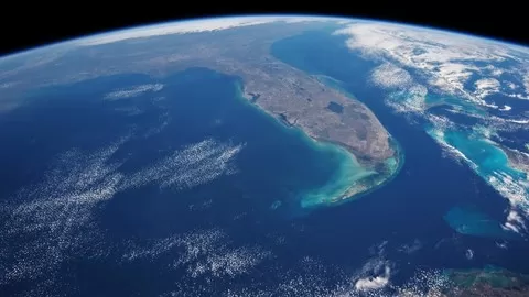
Raster Data with Rasterio: We introduce here the basics of Remote sensing in Python and help you master the ins and outs of satellite imagery processing in Python.

The course is a comprehensive course that teaches you the fundamentals of a career in Geospatial data science.

What can you learn from this course?

✓ Learn Python for Geographic Data Science
✓ Master low-level libraries (Shapely and Fiona) to have an in depth knowledge of Geospatial Libraries
✓ Work with Raster data using Rasterio and Perform the most common Satellite Imagery Proceducres.
✓ Create Fun Geographic Games in Python to master the Language
✓ Learn Geopandas and work on real-world projects to enhance your knowledge

What you need to start the course?

• This is a begginer course. There are no requirements. We start with the Basics and learn the fundumentals including the tools, Python basics, and the Geospatial basics in Python.

Who is this course is made for?

• Begginer GIS programmers.
• Beginner Geospatial Data Scientists
• Data Sceince begginners who want to learn Geospatial Data Science Programming.

Are there coupons or discounts for The Complete Geospatial Data Science with Python Course ? What is the current price?

The course costs $14.99. And currently there is a 82% discount on the original price of the course, which was $84.99. So you save $70 if you enroll the course now.
The average price is $14.0 of 88 GIS courses. So this course is 7% more expensive than the average GIS course on Udemy.

Will I be refunded if I'm not satisfied with the The Complete Geospatial Data Science with Python Course course?

YES, The Complete Geospatial Data Science with Python Course has a 30-day money back guarantee. The 30-day refund policy is designed to allow students to study without risk.

Are there any financial aid for this course?

Currently we could not find a scholarship for the The Complete Geospatial Data Science with Python Course course, but there is a $70 discount from the original price ($84.99). So the current price is just $14.99.

Who will teach this course? Can I trust Abdishakur Awil Hassan?

Abdishakur Awil Hassan has created 2 courses that got 242 reviews which are generally positive. Abdishakur Awil Hassan has taught 1,441 students and received a 4.2 average review out of 242 reviews. Depending on the information available, we think that Abdishakur Awil Hassan is an instructor that you can trust.
Spatial Data Scientist
Abdishakur Hassan is a geographic information systems (GIS) expert and consultant with years of experience working with the United Nations. He holds an MSc in geoinformation science and earth observations. During his tenure as a GIS expert, Abdishakur has developed fully fledged GIS applications in the urban planning and land administration domains. He is interested in all things related to geospatial data science.

8.4

Classbaze Grade®

8.7

Freshness

6.4

Popularity

9.4

Material

Platform: Udemy
Video: 7h 42m
Language: English
Next start: On Demand

Classbaze recommendations for you